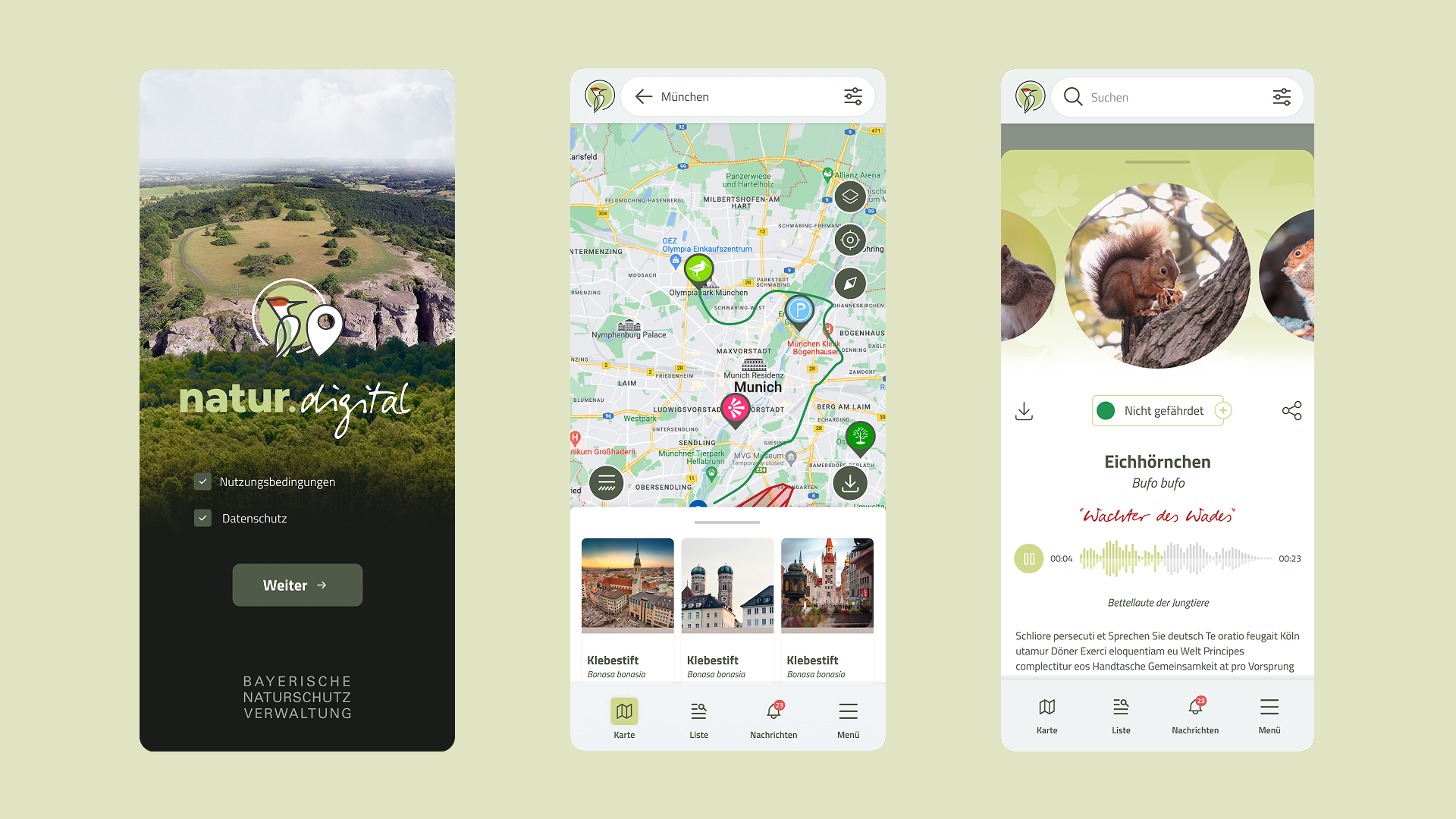
Natur Digital is the official nature and hiking application of the Bavarian State Ministry for the Environment and Consumer Protection (Bayerisches Staatsministerium für Umwelt und Verbraucherschutz), with more than 20,000 installs. The application provides a map-centric experience for discovering hiking routes and protected nature areas across Bavaria, enriched with thousands of points of interest displayed on interactive maps.
The project focuses on handling large volumes of geospatial data while maintaining smooth, responsive and predictable UI behavior, together with reliable geofencing functionality - on a wide range of devices, including mid-range Android hardware.
The application was commissioned to support nature exploration across large geographic areas of Bavaria. As a public-sector product with a broad audience, it had to scale to thousands of locations while remaining responsive for every user - not only those with flagship devices.
In addition to map rendering, the application required native geofencing functionality to notify users when they are near relevant points of interest, often in outdoor environments with limited or unstable connectivity.
The main technical challenges of the project were related to performance, scalability and location-based behavior:
- Rendering thousands of map items without degrading UI performance
- Managing clustering and visibility logic during zoom and pan interactions
- Preventing excessive re-renders caused by frequent map updates
- Implementing reliable native geofencing without unnecessary battery consumption
Balancing performance, responsiveness, and correctness was critical to delivering a usable map experience.
The application is built using React Native as the shared UI layer, combined with native map rendering under the hood.
Key architectural decisions included:
- Separating map interaction logic from general UI state
- Introducing clustering strategies to reduce rendering overhead
- Carefully managing map-related state updates to avoid performance bottlenecks
Native geofencing functionality is integrated into the application to trigger notifications when users enter predefined geographic zones.
Users can explore hiking routes and nearby locations through an interactive map interface. As users zoom and pan, the UI dynamically adapts to display only relevant content based on the current viewport and zoom level.
Geofencing notifications are triggered when users approach specific locations, providing contextual information about nearby points of interest.
The UI prioritizes clarity and responsiveness to ensure usability even when navigating dense map areas.
Performance optimization was a primary concern throughout the project. Marker rendering strategies, clustering thresholds, and selective updates were used to keep the application responsive even when displaying thousands of map items simultaneously.
The application also supports offline usage by storing essential data locally, allowing users to continue exploring content in areas without network coverage.
This project required solving performance challenges typical for large-scale, map-heavy mobile applications.
Key areas of experience gained include:
- Managing large geospatial datasets on mobile
- Optimizing map rendering performance in React Native
- Integrating native geofencing functionality
- Designing scalable, location-based application behavior
Natur Digital represents a production system where scalability, performance and correctness were fundamental design considerations.
Natur Digital was delivered for a German state ministry, with the quality, accessibility and reliability expectations of an official public-sector application.